The Map Does Not Show the Whole Shore
Learn why a shoreline on a map can mislead, and how to read its scale, purpose and date before relying on it for coastal decisions.
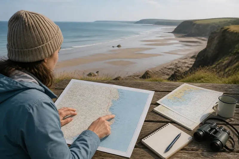
You trace a finger along the blue edge on a coastal map, then look up and see a broad strip of wet sand where the line seemed to promise a clear boundary. The map does not show the whole shore: it shows a shoreline selected, simplified and recorded for a particular purpose. Knowing how to read that selection helps you decide what the line can tell you—and where it may lead you astray.
When the line looks exact
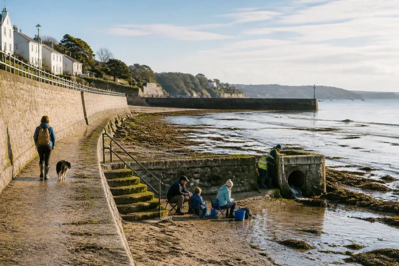
A crisp line can feel more certain than the coast itself. On the ground, however, the meeting of land and water shifts with tide, waves, weather and the material of the shore. A rocky cliff may offer a visually obvious edge, while a tidal flat can expose a wide area at one moment and disappear beneath water later.
Maps have to turn that changing scene into marks that fit a page or screen. A line may represent a chosen tidal level, a surveyed edge at a particular time, or a boundary useful for a specific administrative purpose. It is not automatically a promise that water always touches land at that exact place.
Start by asking what the line is meant to represent. Look for a legend, notes on survey method, an indicated tidal datum or a description of the mapped feature. If the map gives none, treat the shoreline as a general guide rather than a precise boundary.
When detail disappears
A small-scale map covers a large area, so its cartographer must simplify. Tiny creeks, narrow inlets, sea walls and projecting rocks may be omitted or smoothed into a cleaner outline. A large-scale map can show more local detail, though even that detail depends on the map’s purpose and the information available when it was made.
This is much like looking at a coastline through a window: stepping back reveals the overall shape, while moving closer brings small features into view. Neither view is wrong, but they answer different questions. A regional map can help you understand where a bay lies; it is a poor tool for deciding whether a narrow opening exists beside a particular quay.
If a feature seems absent, check the map scale before concluding that it does not exist. Zooming a digital map may enlarge the same simplified data rather than reveal more. Look for a more detailed coastal chart, local authority map or site plan, and check that it covers the place and question you have in mind.
When maps disagree
Two maps can show different shorelines without either being carelessly made. One may depict a tidal reference line, another a physical edge observed during a survey, and a third a boundary adopted for planning or land administration. Their dates, scale and conventions may differ as well.
Compare like with like before choosing which line to trust. Read the legend and notes, check the publication or survey date, and identify the feature each map claims to show. A line marked as a high-water boundary should not be compared as if it were the edge visible at low tide.
For a practical comparison, keep both maps open and identify a fixed landmark that appears on each, such as a harbour entrance or headland. Then check whether their shoreline difference follows a consistent pattern or occurs only around particular features. The pattern may suggest different mapping conventions; a localised mismatch may call for a closer look at newer or more detailed information.
When the coast has moved
Shorelines change as sediment is carried along the coast, deposited in sheltered places or removed from exposed ones. Storms can reshape beaches and dunes; river mouths and tidal inlets can shift; hard coastal structures may alter how sand and shingle move nearby. A map that accurately recorded an earlier shore can therefore be out of date for present-day observation.
Check the date attached to the shoreline data, not just the date printed on the map or shown in the app. A recent-looking basemap can still contain older coastal information. If you need a current picture, compare it with recent aerial imagery or a current local survey, while remembering that imagery also captures one moment and may be affected by tide, weather or shadows.
Say you are trying to understand why a small inlet on an older council map no longer matches the view from a public lookout. You might check the map’s survey date, compare a newer aerial image, then consult the council’s current coastal mapping. The likely result is a better account of what changed and which source is relevant—not a single line that settles every question about the inlet.
When a line implies access
A shoreline symbol can be mistaken for a path, a public boundary or a route around the water. Those are different kinds of information. A map may show the land–water edge while saying nothing about whether a gate, cliff, private holding, tidal channel or other obstacle interrupts access.
Check routes and access markings separately from shoreline features. Look for footpaths, public rights of way, entrances, barriers and notes about closures, then confirm current access information with the responsible local authority where needed. A line beside the sea is not, by itself, evidence that you can walk along it.
For route planning, use a map designed to show paths and access, and treat the shoreline as context. If the route approaches a narrow headland or tidal area, check whether the map supplies relevant access or tide information rather than inferring it from the coastal outline.
What should you check?
What does the shoreline line represent?
Read the legend and map notes for the stated boundary, tidal reference or survey method. If the line’s meaning is not explained, use it to understand general shape rather than to decide an exact edge.
Does the map scale suit the question?
Look at the scale bar and the amount of detail around the place you care about. For a narrow inlet or small harbour feature, seek a more detailed source instead of assuming a zoomed view has added information.
How recent is the coastal information?
Check the date of the shoreline data as well as the map’s publication date. Where the coast is visibly changeable, compare with current imagery or information from the local authority.
Is the map showing access as well as the edge?
Look for path symbols, access notes and restrictions as separate map features. If the route matters, confirm that it is open and usable rather than treating the shoreline itself as a route.
Choose the right map
Begin with the decision you are making. A regional map can orient you to bays, headlands and settlements; a detailed chart or survey may answer a question about water and shore features; a local access map can clarify paths and public approaches. No single source is best for every purpose, so match the map to the question.
When the answer matters for a boundary, planning decision or other formal use, rely on the relevant official mapping and seek advice from the responsible authority or a qualified professional. For ordinary orientation, the map’s title, legend, scale, date and source are a useful first check.
The map does not show the whole shore, but it can still be a thoughtful guide. Read its line as information with a purpose and a time attached, then use the source best suited to the detail you need. That small habit makes a coastal map easier to trust for what it actually says—and easier to question where it stays silent.