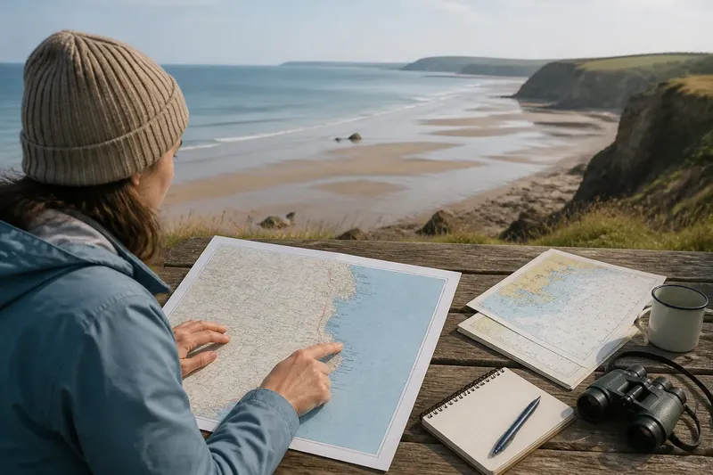
A Shoreline Is an Edge, a Route and a Meeting Point
See how a shoreline works as a boundary, a route and a shared meeting place, so you can read its changing uses and choose where to pause or pass.
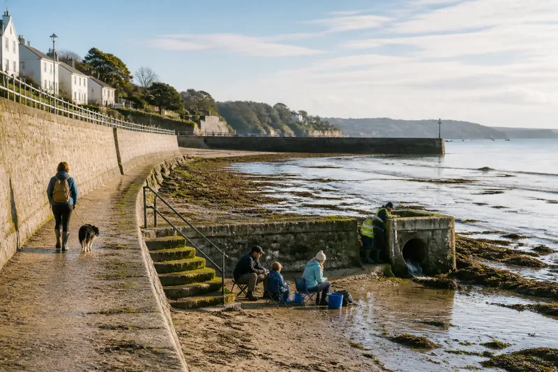
At low tide, a dog walker follows the firm strip below the sea wall while a fishing family settles beside a set of steps and a council worker checks a drain outlet. They share the same shoreline, but not the same purpose. A shoreline is an edge, a route and a meeting point at once; noticing these roles makes its everyday arrangements easier to understand.
These three functions overlap, and none stays fixed along the coast. Here are five ways to read what is happening underfoot and around you.
1. Read the boundary
The shoreline marks a meeting between land and water, but it is rarely a crisp line. On a rocky coast, the boundary may shift across shelves and pools. On a tidal flat, the water’s edge moves over a broad stretch of mud or sand. A wall, dune, harbour structure or planted bank can create a visible edge without matching the natural reach of the sea.
That distinction matters in ordinary decisions. A path may look close to the water at one point, then sit well above it where the shore curves. A gate or fence can mark a managed area, while a wet line on rocks can show where waves have recently reached. Each sign describes a different kind of boundary: physical, constructed or administrative.
Think of the shoreline like the seam on a coat: it joins two surfaces, but it can bend, widen or be reinforced. The analogy helps explain why a single line on a map cannot capture every change visible from the ground. When walking, look for transitions in material and form—dry paving to shingle, grass to dune, or rock to tidal water—rather than assuming the apparent edge is uniform.
2. Follow the route
Many shores offer a way through a place as well as a view of it. A firm beach margin may connect a slipway to a cluster of homes; a harbour edge may carry people between a bus stop, a ferry landing and nearby shops. Sometimes the route is a marked path. Sometimes it is a customary line of movement, shaped by the ground and the activities beside it.
Shore routes can also be conditional. A stretch that is easy to cross at one tide may be submerged or cut off at another. Loose shingle, seaweed, steps and ramps each ask for a different pace. The route’s usefulness depends not only on where it leads but on whether its surface and access points suit the people trying to use it.
Imagine a visitor arriving at a small inlet with a pushchair. The broad paved approach ends at a low seawall, while a gentler ramp lies around the curve beside a boat shed. Choosing the ramp may make the trip possible without blocking the narrow landing area. The observable difference is a more direct passage for others and a less awkward route for the visitor; it is a matter of reading how the shore is arranged, not of assuming every waterfront offers the same access.
3. Notice the meeting points
At the coast, activities often gather where one kind of ground meets another. Steps give people a way to reach the water; a ramp serves small boats; a sheltered corner offers a place to watch the tide. These are practical thresholds, but they also bring people with different intentions into close proximity.
That closeness can be sociable, or it can create friction. Someone sitting to eat may be beside a route used by people carrying fishing gear. Children exploring a rock pool may be near a working landing. The useful question is not simply who belongs, but what each person needs from that particular patch: passage, room to work, a safe place to pause or access to the water.
Small design cues can help people share space. A clear approach to a landing, a bench set outside the main flow, or a sign indicating a working area can make different uses legible. None removes every conflict, and informal courtesy remains part of public life. Still, when the function of a place is visible, visitors can make better choices without needing to know its history.
4. Check the changing edge
A shoreline changes with tide, weather and the movement of sediment. A calm-looking inlet can still have wet rocks; a beach may lose its dry margin as water rises. In some places, the edge is also shaped by structures such as groynes, harbour walls or drainage outlets. These alter how the shore is experienced, even when their purpose is not obvious from a casual glance.
Before relying on a route close to the water, consider whether it has an easy way back to higher ground. Notice tide information where it is provided, and pay attention to local signs and closures. If the available route narrows or the surface becomes slippery, turning back is a sensible choice rather than pressing on to keep to a planned line.
Where access rules, warning signs or facility guidance apply, follow the posted information and the relevant local instructions. A shoreline can be public in character while particular structures or working areas have limits on access.
5. Ask what the place serves
Looking at a shoreline through its uses can reveal why its parts differ. A seawall may protect nearby streets; steps may make bathing or launching easier; an open strip may let people move along the water without entering a working harbour. These purposes can sit side by side, though they may call for different arrangements and priorities.
It helps to separate the broad idea of public access from the details of a particular location. A waterfront may invite visitors while also supporting essential work. A path can be continuous in one direction yet have a short interruption around a facility. Instead of treating such features as quirks, read them as clues to how the shore is shared and managed.
When you revisit a familiar stretch, notice what has changed in the pattern of use: where people pause, which approaches remain open, and whether a route serves walkers, workers or both. This close observation is a practical way to understand the shoreline as part of civic life, not just a boundary on a map.
Shoreline questions?
Is a shoreline the same as a coast?
“Coast” usually refers to a broader area where land meets the sea, while “shoreline” points more directly to that meeting edge. In everyday speech the terms can overlap, but the shoreline’s exact shape and position may vary with tide and terrain.
Can a shoreline be both public and working?
Yes. A waterfront can provide space for public movement or recreation while also serving boats, maintenance or other coastal functions. Look for signs, marked routes and working areas so your visit does not obstruct them.
Why can the water’s edge look different on each visit?
Tide, wave action and shifting sand or shingle alter what is exposed and where water reaches. Weather and coastal structures can also change the visible conditions, so a familiar view is not a promise that the same route will be passable.
How can I tell whether a shore route is suitable for me?
Check the surface, slope, width and access points, along with any local notices about conditions or closures. If a key part of the journey is unclear or inaccessible, seek local access information before setting out.
Reading a shoreline as an edge, a route and a meeting point gives you a fuller picture of the place in front of you. The next time you reach the water, pause at the transition between surfaces and notice who is moving, who is staying and what the space allows; that small observation can make the coast easier to share.