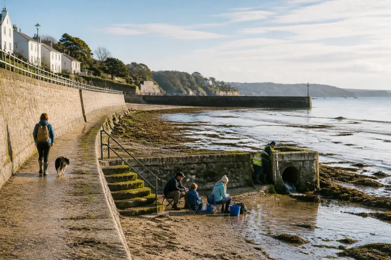
A Slow Walk Along a Harbour Edge
A slow walk along a harbour edge helps you read how public paths, working structures and sheltered spaces fit together, without nearing restricted areas.
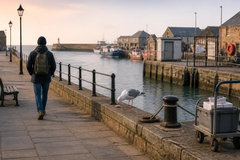
A gull picks at a crust beside the harbour path while a delivery trolley rattles past. On a slow walk along a harbour edge, that small moment can tell you where the public route meets the working waterfront—and where the two remain carefully apart. Take an ordinary path, stay within marked public areas and let the order of places, rather than a destination, guide your attention.
Begin with the approach
Notice how you reach the water. A harbour might open suddenly at the end of a street, or reveal itself gradually between warehouses, boat sheds and a line of parked vehicles. The approach is part of the waterfront’s design: it shapes what visitors can see and which routes feel public.
Look for clear signs, pavement changes and openings in fences. A broad paved route may continue past a small landing, while a narrow gate or marked boundary signals that the way beyond is not for visitors. You do not need to test a boundary to understand it. Read signs from the public path and continue along the route intended for general access.
Notice what the harbour hides as well as what it reveals. A wall might block a view of the working basin but leave an open sightline towards the entrance. From a safe public place, ask yourself what each change in height, surface or direction lets you see.
Read the path sequence
Follow the route at an unhurried pace and note its transitions. Smooth paving may give way to rougher stone, a kerb may mark a change in use, and a railing may turn the path away from an exposed edge. These changes can show where a public promenade passes close to operational space without inviting visitors into it.
Pay attention to choices in the route. Is there a clear way around a closed gate? Does the public path continue beyond a viewing area, or end at a signed stopping point? A ramp, steps or level crossing may connect the harbour edge to nearby streets. The details help you understand who can use the route and how the waterfront meets the neighbourhood.
Keep your walk on surfaces open to the public. Do not step onto mooring platforms, slipways, loading areas or working piers unless they are expressly open to visitors. Their purpose can be easy to misread from a distance; a gap in a barrier is not an invitation to enter.
Watch the structures
From the path, look across the harbour for the structures that organise movement and shelter. Quay walls hold the edge in place; bollards and rings provide points for securing boats; fenders cushion contact between vessels and the quay. A breakwater may sit farther out, reducing wave action inside the harbour. These objects are not just background: their arrangement helps explain where boats move and where people are expected to stand.
Notice how different structures meet. A sloping ramp, a vertical wall and a floating pontoon serve different conditions, even when they sit close together. A line of bollards beside a public path may indicate a mooring edge, while a separate rail keeps walkers set back from it. Treat the rail as a boundary, not a prompt to lean over for a better view.
Imagine you arrive at a small harbour with a signed promenade, a low quay wall and a gated service pier. You follow the promenade, pause at a public viewing point and look from the safe side of the rail: the gate separates visitor space from operational space, while the quay and moorings show where boats are secured. You can read the layout without crossing the boundary or approaching equipment.
Notice shared spaces
Harbour edges often bring different routines close together. Walkers may share a wide path with people carrying fishing gear, cyclists or visitors heading towards a ferry stop. Observe where people pause, where they pass one another, and whether benches or marked viewing places sit outside the main flow.
Small design choices can make shared use easier to read. A painted line may separate a cycle route from a footway; a change in paving may guide people towards a harbour building; a bench set back from the path leaves room for through-traffic. If a route feels busy, step aside only where the public layout allows it, rather than moving onto a service apron or near a vehicle entrance.
Look for signs of everyday care as well. Bins, life rings, information boards and lights can indicate the facilities provided for visitors, though their presence does not make every nearby space open for public use. Note where signs are placed and what they clarify: directions, access restrictions, harbour rules or emergency contacts.
Listen for the working harbour
Sound can help you understand the sequence of places without drawing you closer. A low engine note may come from a vessel manoeuvring; chains, ropes and halyards can knock or rattle; footsteps and conversations may gather around a public landing. Pause on a clear, safe part of the path and listen for how these sounds change as the route turns or passes behind a building.
Let sounds remain clues, not instructions. An engine or shouted call is a reason to give working activity room, not to look for a closer vantage point. Keep clear of vehicle entrances, loading zones and marked operational areas, and do not obstruct people carrying out harbour work.
Wind also changes the feel of the walk. A sheltered corner may be quieter and more comfortable, while an exposed stretch can make signs harder to read and the path less pleasant. Choose a public place to pause where you are out of the way; if conditions make the route uncomfortable, turn back rather than pushing on.
Questions along the way?
What should I notice first?
Start with the public route: its entrances, surfaces, signs and boundaries. Those features show where a visitor can walk before you look more closely at harbour structures.
Can I walk onto a pier?
Only use a pier or landing that is clearly open to the public. If access is restricted, gated or unclear, stay on the signed route and view it from a public place.
How can I tell where boats are secured?
From a safe distance, look for mooring lines, bollards, rings and fenders along the quay. Avoid approaching these fittings or stepping onto surfaces used for mooring or loading.
What if the path ends at a barrier?
Stop at the public side and check for signs directing walkers to another route. If none is provided, turn back rather than passing the barrier or searching for an informal way through.
Keep a short record
A few notes can preserve the order of what you saw without turning a calm walk into a survey. Write down the approach, the main changes in the path, a structure that caught your eye and the point where public access ended. A simple sketch can use arrows for the route and small labels for features such as a wall, bench or sign.
Keep the record grounded in what you can see from public space. A harbour map or information board may name a structure, but a practical note can simply say “rail beside quay” or “ramp beyond viewing area”. If you photograph the walk, include enough of the public setting to show where you stood, and avoid framing people or private work areas without a good reason.
The phrase “slow walk along a harbour edge” works best as a reminder to notice sequence, not to seek access everywhere the water seems close. On your return route, look back once from the public path: the entrance, shared spaces and working structures may now read as one connected arrangement, with each boundary doing a quiet but useful job.